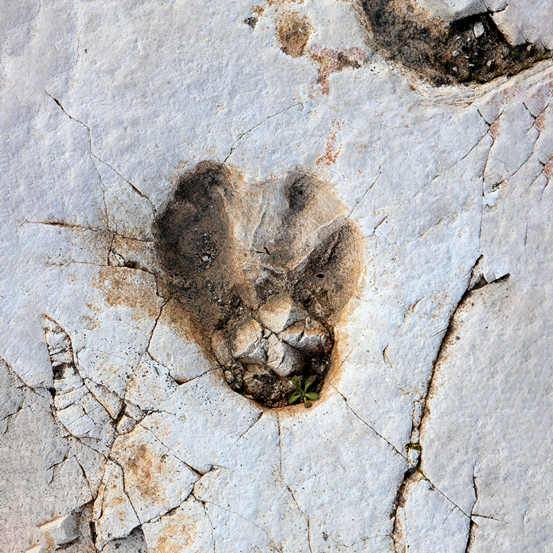
Adria, or rather what is left of it, was a continent or more precisely a tectonic plate that, in the dinosaur period, formed low lands and shallow seabeds in the ancient Tethys Ocean. The climate was tropical, and this vast area stretched between two immense continents-Laurasia to the north and Gondwana to the south. Continental drift, which fragmented Pangaea, led to the present distribution of landmasses, and Puglia itself is an undeformed fragment of the area that was once an immense dinosaur archipelago.


After its emergence during the formation of the Italian peninsula, many events marked Adria, creating new rocks and new landscapes. Again, it is possible to “photograph” these periods of the past through particular locations that allow us to understand what happened in ancient times. These locations, which allow us to touch and see the past through the scientific nature of the rocks, their use by man, or their landscape appearance, are the geosites.
In the Alta Murgia and Premurge territory, geosites are countless. To understand each location and place it in time, it is useful to illustrate the “calendar of the past”: the geological time scale. This scale tells, through the names given to the various time intervals, how old the events we are talking about are. The abbreviation “Ma” next to a number represents the abbreviation for “Millions of Years.”

Adria’s story includes the last colored piece at the end of the calendar defined by the time scale.

of a hidden history
An area where it is possible to find remote traces with karst formations such as sinkholes, caves and plateaus. The link between Adria and the Alta Murgia is not only geological, but also cultural. It is, in fact, an area of great scientific interest, where scholars of geology and paleontology can study the signs left by plate movements.


